


Walking the Coast Path - Lands End to St Ives
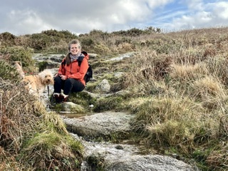
It's the New Year, and with things a little quiet around here, I've set myself a challenge - to walk the Cornish Coast. It turns out that it's also on my friend's bucket list too, so with a partner in crime (Jo), we leave a car at each end and head off along the coast.
Here is a diary of the first section of the challenge, Lands End to St Ives. We hope you enjoy the notes, and if you're also treading the coastal path, I hope you find some of this useful. You can also keep up to date with photos and videos on our Facebook page - @Demelza Cottage Smallholding and Holiday Let.
Lands End to Cape Cornwall
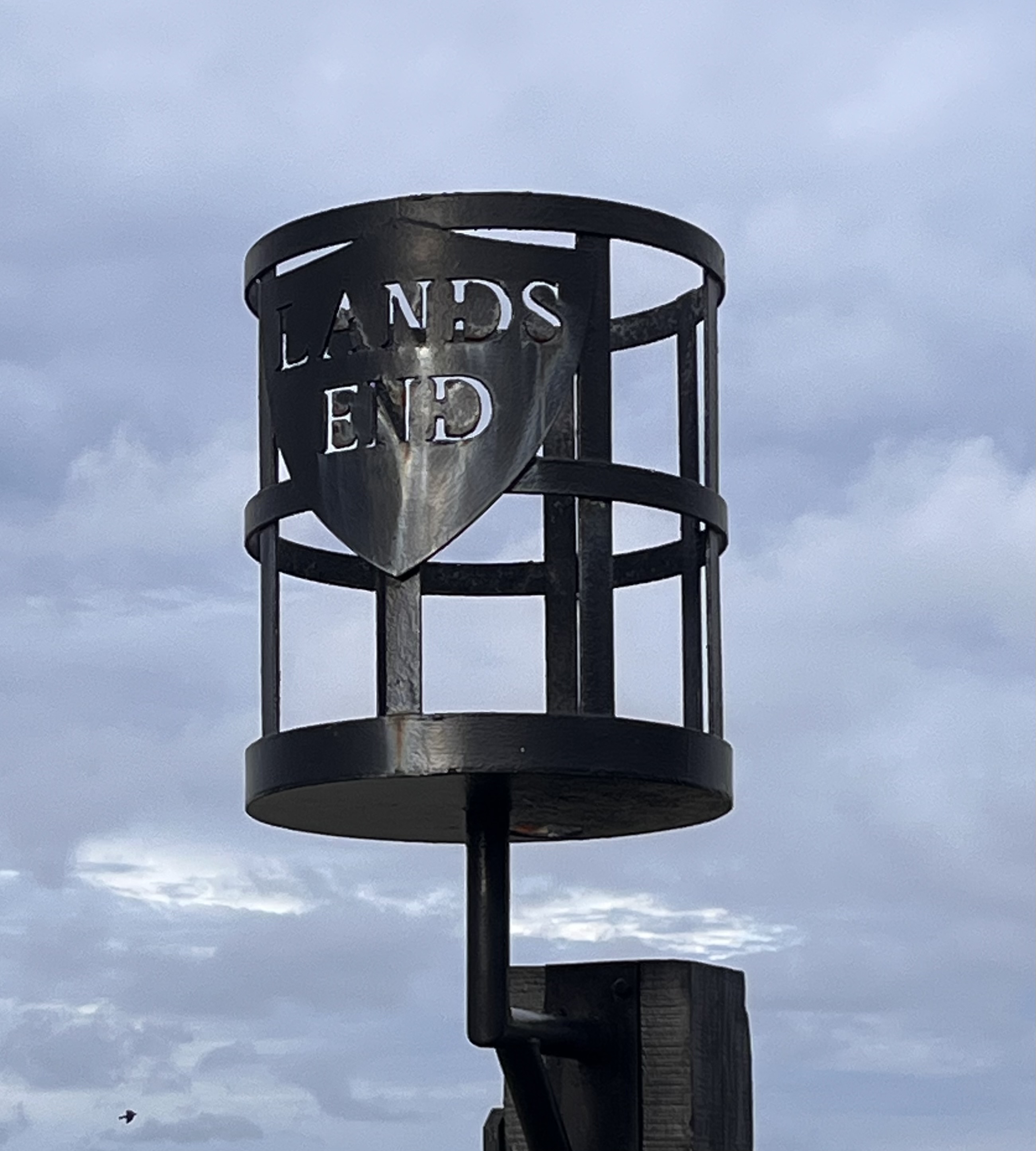
We parked at the Lands End Visitor Centre, and as Cornwall residents, we picked up a free parking pass which was quite handy. Jo left her beautiful camper at Cape Cornwall so we could drive back later, and with a National Trust membership, we could park there for free too.
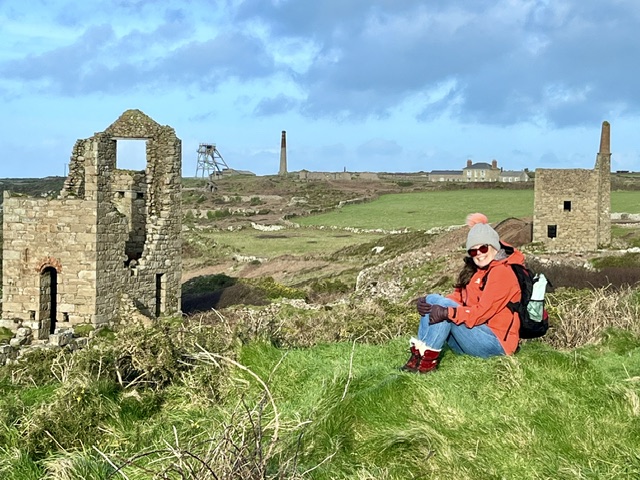
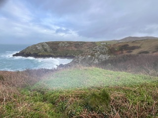
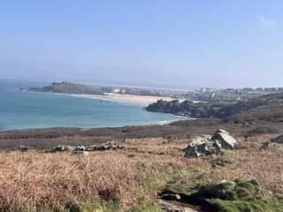
Lands End was mostly closed, but there were several tradespeople fixing up damage after Storm Goretti. It had hit the region pretty hard, with many roofs missing tiles and large trees down. After a quick photo at our starting point, we headed off on our adventure. This is a stunning stretch of coastline, very rugged and with far-reaching views to our destination, Cape Cornwall.
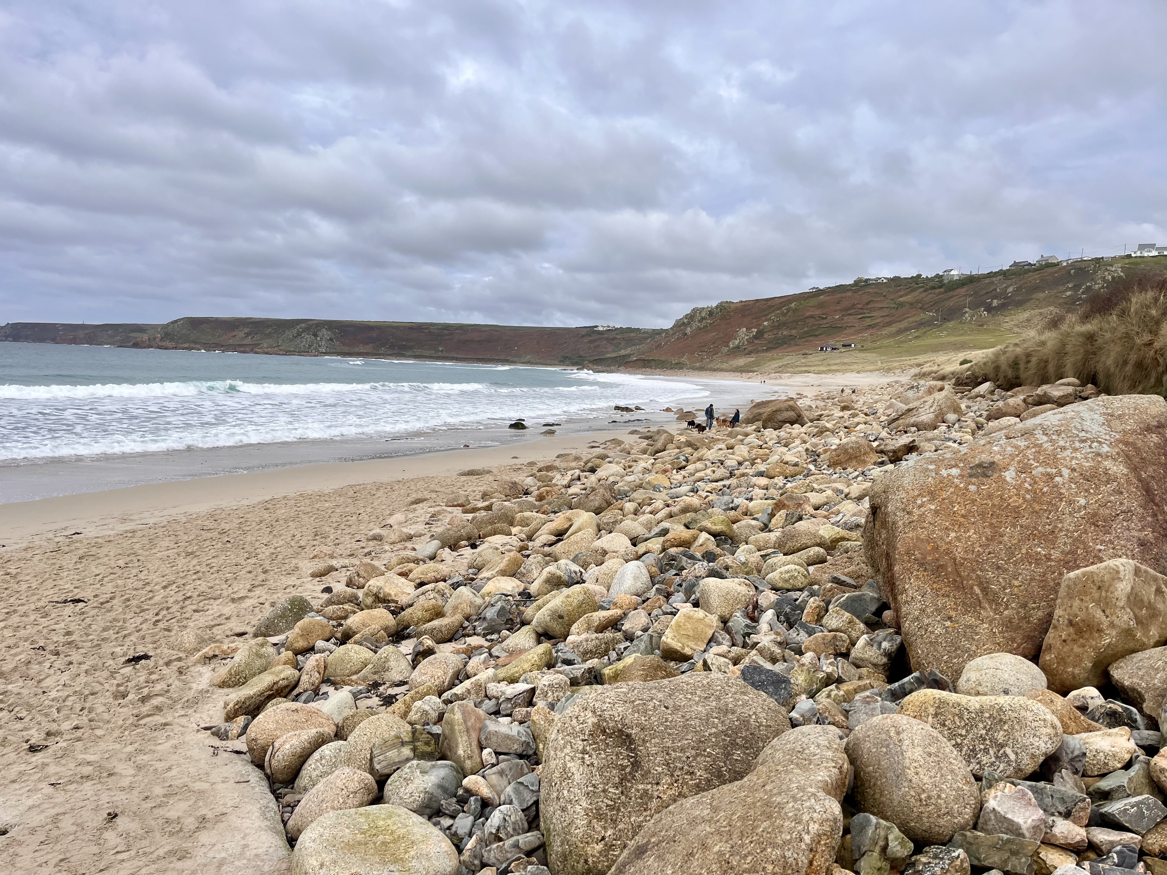
It didn't take long to reach Sennen and the path took us down to the harbour via some steep steps. Here, there was a lot of damage to buildings from the storm, one property had lost nearly its whole roof. We had lunch on the stunning beach at Sennen, and then headed uphill via some steps by the beach car park. This part was quite steep, and we ended up getting a bit lost, heading up to the road behind a small development of homes, where we should have veered off a level further down. In the absence of a map (Jo had left it in her car), we followed the road until it picked up another path which took us across a stream and a bog with stepping stones to help us navigate the path.
At a farmhouse, we asked for directions back to the path and picked it up about two miles from Cape Cornwall. The detour cost us a few extra miles, so by the time we were close to Cape Cornwall the light was fading. We did the last stretch with a torch for some extra visibility and arrived at the car park, just as it started to rain. We were looking forward to a cup of tea before heading back to pick up my car. Instead, Jo announced that she had left her keys in the car!! After considering who in our address book lived nearby, we were fortunate to come across the last person in the car park (other than us). The poor chap was confronted by two weary middle-aged ladies, and he took pity on us giving us a lift back to Lands End. I hope he got home safely, as his car was pretty much running on empty and the number of fuel stations was few and far between. Our thanks go to Jacob, a bit of a hipster, who was our knight in shining armour. This felt like quite a challenging day, I think because we walked a few extra miles than expected. We were quite tired, but in need of a pub visit after the day's adventure. About 7 miles and took us 4.5 hours with lunch.
Cape Cornwall to Pendeen Lighthouse
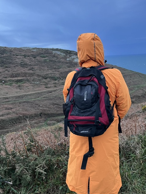
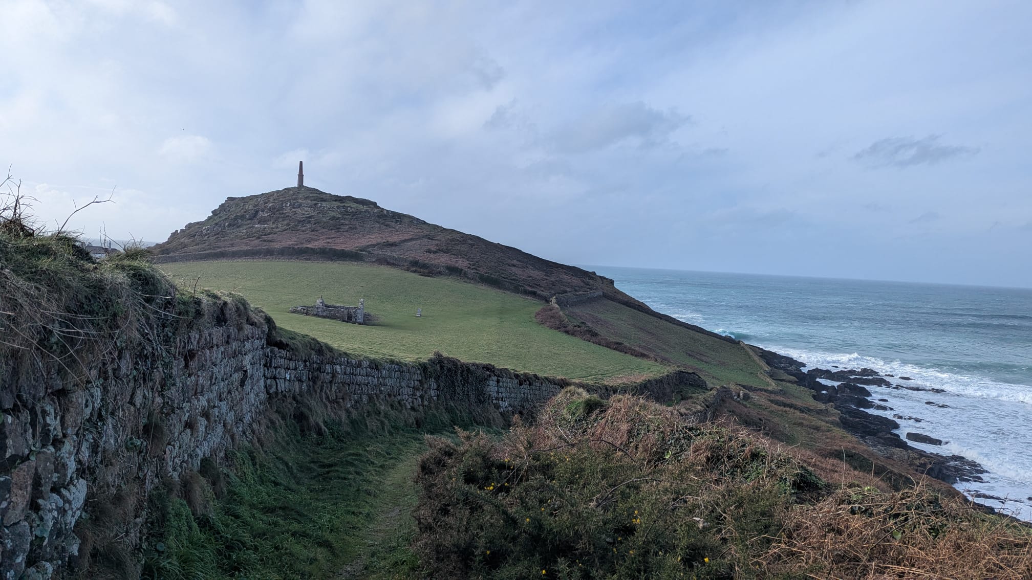
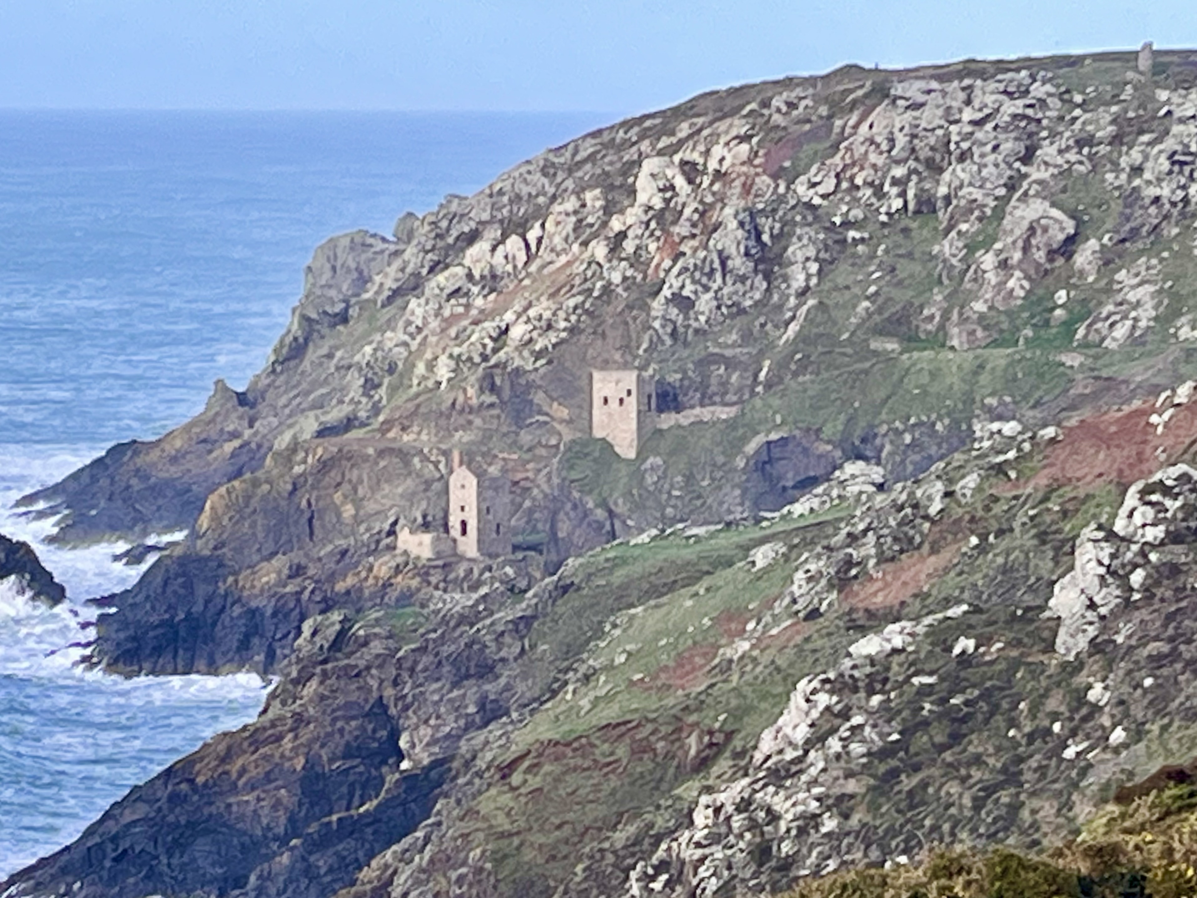
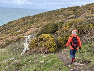
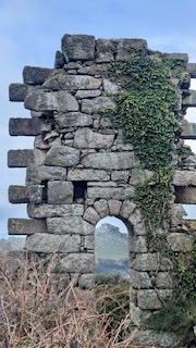
With all keys accounted for and the map packed, we felt a little more organised for the next leg of our journey, although I did forget my hiking stick. We headed up to Cape Cornwall with a brief stop to admire the view. All along this stretch of coastline are the remnants of Cornwall's mining heritage, with evidence of Cornwall's mining heyday - chimneys, engine houses, and industrial buildings can be discovered at Levant, Botallack and Geevor. There had been a lot of rain, after another storm, Chandra, so we saw waterfalls in full flow. It also meant some areas had flooded and we had to wade through several areas of the path - all part of the adventure, but it did slow us down a little. It was a windy day, but fortunately dry, and the waves were awesome. Great, rolling waves, that crashed onto the rugged coastline, billowing spray up the cliffs as a stark reminder of the power of the Atlantic and the numerous ships that have met their peril in this area.
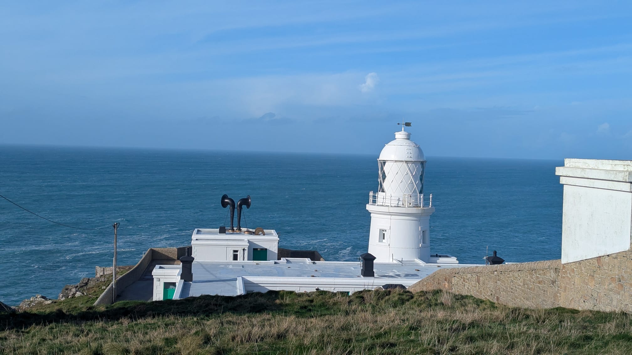
The walk was only 4 miles, but there were a few climbs and descents on this stretch. It took us about 3 hours, with a short stop for lunch, and we got back to the car park just as it started to rain. Free parking at Pendeen lighthouse, but only a few spaces.
Pendeen Lighthouse to Porthmeor Cove
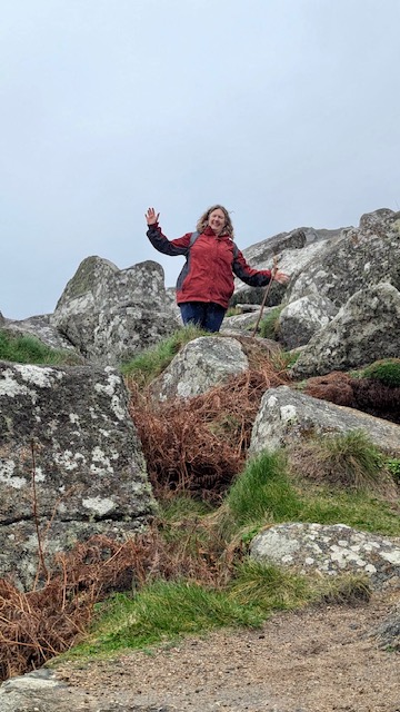
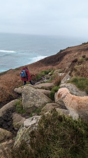
We parked again at Pendeen Lighthouse and then took the path following the back of the lighthouse. This path then veered uphill with fantastic views towards our destination. This stretch of coastline is characterised by its granite landscape, imposing cliffs of granite, tall outcrops, and boulders along the route. After record levels of rain in Cornwall, the path, especially around Morvah was very wet and boggy, and the way was made up of large cobbles, so the terrain was hard-going on the feet and ankles. I was very grateful for my decent walking boots and hiking stick. There were some pretty steep climbs too, scrambling up and down rocks, picking our way through the path. The views, though, were amazing. Rough, rugged, remote, and somewhat spiritual, not dissimilar to Bodmin Moor. We saw seals at Portheras Cove and soon after stopped for lunch with a stunning aspect. Looking out to the sea, there was a large outcrop of granite which looked like a sleeping giant, face turned up to the sky. It was the type of place where legends are made, and where ships can quite easily find themselves in trouble. From Porthmear Cove, after a brief stop to watch guillemots diving for their afternoon tea, we headed inland to our vehicle, which we parked just off B3306 near a cattle grid.
Porthmeor Cove to Zennor
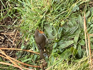
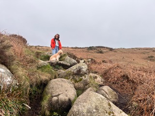
This stretch of coastline was remote and challenging, mostly picking our way through the path, some of the climbs and boulders were formidable, but actually great fun. The weather was a bit damp and very, very windy. We crossed several waterfalls and some of them were flowing in reverse! There wasn't much shelter for a lunch stop, so we hunkered down next to a derelict mining building and were joined by a little robin. For those a bit superstitious, a robin is seen as a sign of a loved one nearby. I'd like to think that my dad was cheering us on, or trying to tell us that we were slightly derangesd and might be better off heading to the pub. There are two pubs along this stretch, the Gurnard's Head and the Tinners Arms, both of which we can testify are welcome breaks from the wet and windy weather. Just as we approached Zennor Head, there was a final steep set of granite steps and boulders to navigate. And a stroll up a path from Zennor's Head to the hamlet of Zennor, where we parked our car for a small fee via an honesty box. At this point on the coast path, my old faithful boots had given up and started to let in water, and having been wet for quite a lot of this walk, I was grateful for the change of clothes I brought with me in the car. A quick change and we headed into the Tinners Arms to warm up and plan our next route over dinner.
Zennor to St Ives
We were short of time for a couple of walks so we did this stretch in two parts, Zennor to Trevega Cliff and then on to St Ives. It was a good opportunity to wear in my boots. The first stretch saw us go over more granite boulder territory, but some of the paths towards St Ives started to feel more like a path, than a stepping stone track. We saw several seals bobbing up and down in the sea, which brought our tally up to 14. We had several stops (mostly to catch our breath), to watch the waves crashing onto the shore. Some of the paths were flooded in places, and I was grateful for decent waterproof footwear that could cope with the terrain. We found places to park in Treveglas and at Porthmeor Beach in St Ives, although the time limit at Porthmeor Beach had us racing back to the car. I would recommend finding a long-stay car park, so that you can enjoy the walk and not have to worry about stopping for a break.
And so, that is the first stretch of our South West Coast Path experience complete. Lands End to St Ives, approximately 24 miles, but felt like 50!
In summary, this is a very rugged stretch of the coast path, in some places, more like mountaineering, than a gentle amble along the coast. Our average speed was about 40 minutes per mile, so if you are thinking of undertaking this stretch of path, add a lot of contingency time for the terrain that you will be tackling. In hindsight, we probably should have started somewhere where we could get our fitness up gradually, and somewhere less wet, but then we did start in January, just after one of the worst storms to hit Cornwall and during the wettest winter on record. All I can say is if we can do it, anyone can do it, but I would recommend not doing this stretch in winter on your own. It is very remote, inaccessible and you rarely see other people on your journey. The views however are magnificent - rugged cliffs, sandy bays, huge escarpments of granite, waterfalls and a lot of mining history.
We hope you've found this blog useful. Continue with us on the next leg of our journey St Ives to Newquay.